


-
The storm came ashore on Thursday night, just east of where Tropical Storm Fred made landfall last month. It will gradually weaken as it crosses Georgia and enters the Atlantic later in the day.
-
 The disturbance strengthened Wednesday afternoon and is forecast to make landfall in the Florida Panhandle Wednesday night.
 -
 Forecasters say a tropical or subtropical depression, or named storm, could form before moving inland over the Florida Panhandle on Wednesday night.
 -
 More than 75 Florida deputies are aiding Louisiana law enforcement agencies overworked from Hurricane Ida.
 -
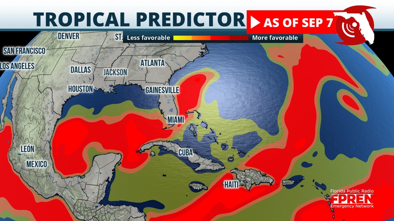
A disturbance in the Gulf of Mexico will produce widespread heavy rainfall on the central and northern parts of the state.
-
 A group of University of Miami graduate students created the blog "Seasoned Chaos" last year to help make sense of the complicated physics behind climate change.
 -
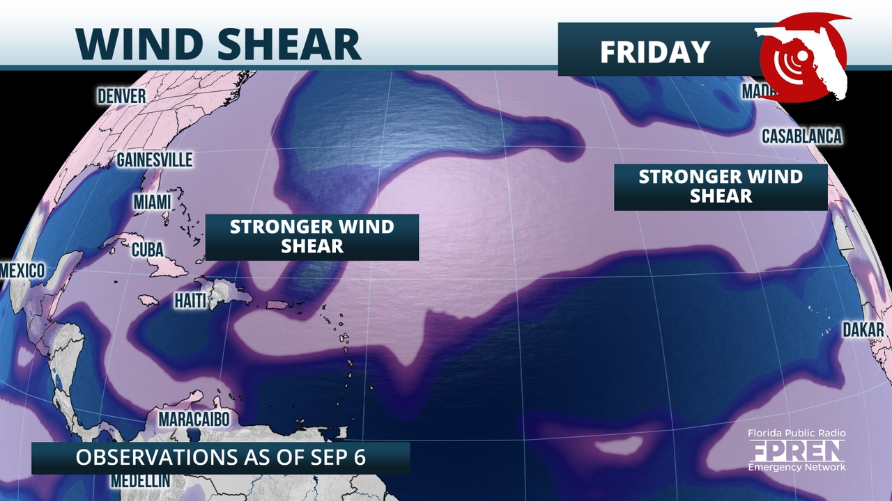
Wind shear should prevent the system from becoming too strong over the Gulf, but it is poised to bring higher moisture northward from Louisiana to Florida this week.
-
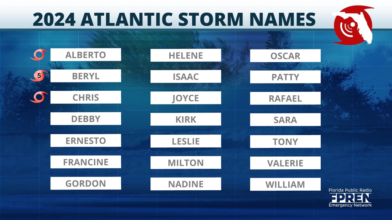
 Larry is a major hurricane in the central Atlantic, and there are no tropical threats to Florida in the next five days.
 -
 Tropical Storm Larry is expected to become a Category 3 hurricane but should stay over the open waters during Labor Day weekend.
 -
 The HistoryMiami museum took down items on the Surfside memorial wall, that honored the victims of the Champlain Towers South collapse, to care for them and preserve them as the peak of hurricane season looms.
 -
 Heavy rain is likely to expand southward into the I-4 corridor during the day Wednesday.
 -
 A spokesman for AAA says the price of gas could increase 10-20 cents a gallon this week.


