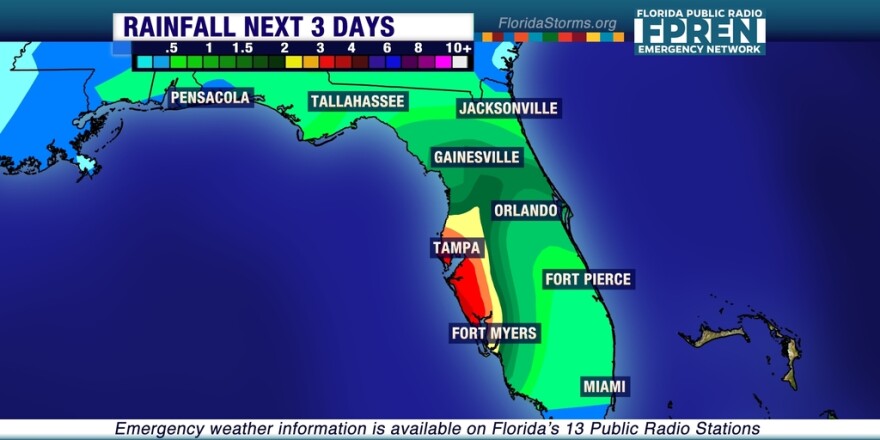
A Flood Watch is in effect again today for
An rare late July pattern has sent a front and an area of low pressure unusually far to the south, moving all the way into central Florida over the weekend. The now stalled front will be the focusing mechanism for multiple rounds of showers and thunderstorms with heavy rain through midweek, and in some cases the additional heavy rain could exacerbate the ongoing flooding in west-central Florida.
The heaviest rain will likely occur near and just north of the I-4 corridor Monday and Tuesday, with amounts ranging from up to three inches near the Gulf Coast to about an inch on the Atlantic side. A Flood Watch is in effect for west-central Florida, including the Tampa metro area, and recent flooding in Pasco County has prompted evacuations of some residents along the Little Manatee River.
The front and low pressure system is forecast to weaken and drift south by the end of the week, delivering some much needed rain to parts of south Florida, while lessening the impact on water-logged areas central and north Florida.


