In 2017, mighty Hurricane Irma delivered a stinging sideswipe to Miami-Dade and other parts of South Florida.
Across most of the area, the blow from the Category 4 storm, whose eye made landfall miles away in the Florida Keys, was felt at most as that of a tropical storm. That was bad enough: The wind and rain damaged roofs and felled trees and power lines, knocking out power for days — most notoriously claiming the lives of 12 seniors in Broward County marooned at a nursing home without electricity.
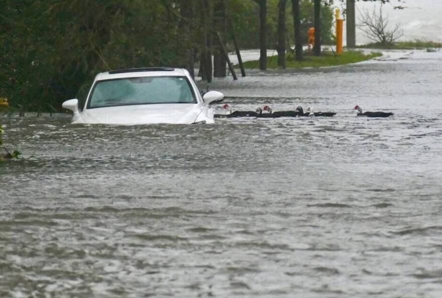
Along the Biscayne Bay shoreline, though, Irma’s wind strength was that of a Cat 1 hurricane — strong enough to drive a surge of saltwater of three feet to over six feet several blocks into Miami’s Brickell and Coconut Grove neighborhoods, shattering docks, marinas and boats, flooding streets for days, inundating Vizcaya and the Barnacle, and depositing a fleet of sailboats and other vessels on land along South Bayshore Drive and the yards of homes on the bay.
Canals that normally drain into the bay, backed up as the surge pushed inland, overflowed their banks into neighborhoods, streets and homes.
The damage from the swiftly moving wall of bay water, limited in scope and size as it was, took in many cases years and millions of dollars to repair.

Yet that was only a small taste of what Miami-Dade County could experience should a storm the size and strength of a Hurricane Ian, which pushed at least 15 feet of storm surge ashore in Fort Myers Beach, score a direct hit on Biscayne Bay and the dense population centers that occupy the barrier islands that protect it. Those include Key Biscayne, Miami Beach and the row of beach towns stretching for miles to the north along a series of questionably fortified barrier islands.
Public concern about hurricanes is centered mostly on wind damage, experts note. But a large, slow-moving Category 4 storm like Hurricane Ian would push a catastrophic surge across much of coastal Miami-Dade many times worse — and extending much farther inland — than Irma’s, National Hurricane Center surge risk maps show.
And that’s something that many experts say Miami-Dade remains in many respects unprepared for, both psychologically and physically, as we continue to add residents and pile on denser development in vulnerable areas from Miami Beach to Brickell and South Miami-Dade amid seas and underground water tables swollen by climate change.
'You can't beat the surge'
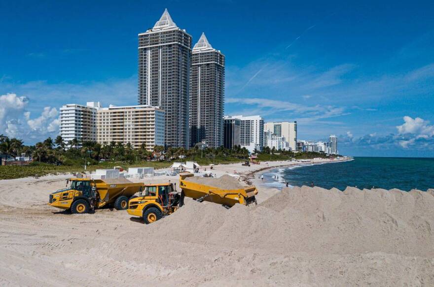
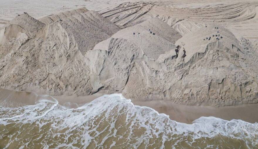
Public officials at the county and vulnerable municipalities are well aware of the risks. Building codes already require that new homes and commercial buildings in zones most susceptible to surge be elevated so water can flow through without destroying them. Miami Beach and Key Biscayne, with help from the federal government, have spent millions to rebuild protective dune systems and renourish beaches along their Atlantic coastlines. And authorities are studying new, naturally inspired ways of blunting the force of storm surge, from artificial reefs offshore to new mangrove islands and “living shorelines” along the bay.
But even the best solutions will at most reduce, but not block, the impact of surge from a major storm. Many of those are years away. And even then, they will only buy around 30 years of time before rising seas will overwhelm the defenses once again. Meanwhile, thousands of older homes and buildings at ground level remain highly vulnerable to surge.

“What you see in Southwest Florida shines a giant spotlight on our vulnerabilities and what we need to do,” said Roland Samimy, chief resilience officer for the Village of Key Biscayne, which sits a mere 3.4 feet above sea level, and where voters last year approved a $100 million funding stream to back large-scale resilience projects.
“You can only protect yourself so much in surge. There’s always going to be an impact. You’re never going to eliminate it. You can’t beat the surge.”
When that big storm hits Biscayne Bay sometime in the future, the surging waters will be rising from a higher starting point: Local sea levels already have risen eight inches since 1950, according to NOAA tidal gauge data, and they’re projected to rise another 16 to 32 inches by 2070, according to the Southeast Florida Regional Climate Change Compact.

In vulnerable areas of Miami-Dade, experts say, the sheer weight and force of rapidly advancing water and cresting waves can do more damage to buildings, bridges, power grids and other public infrastructure than lashing wind and flooding from rain. It is water, not wind, that causes most hurricane deaths. That’s what happened when Hurricane Ian drove a massive pile of water across Southwest Florida’s Captiva and Fort Myers Beach, in some cases sweeping away homes, bridges and other structures on both barrier islands, and claiming more than 120 lives, most by drowning.
“Moving water has great force, and that’s what causes most of the damage,” said Denis Hector, an architecture professor at the University of Miami and an expert in hurricane structural mitigation and resiliency.
Irma visited Coconut Grove
The Miami region is no less susceptible to surge than the Fort Myers area — and significantly more so than oceanfront cities to the north, like Fort Lauderdale or Palm Beach, the Hurricane Center maps show. That’s because of the relatively shallow water in Biscayne Bay, which can fill like a tub and overflow violently miles into the mainland and across the back of Key Biscayne and the beaches.
The bay has an average depth of less than six feet. As strong hurricane winds whip ocean water toward shore, the shallow floor of Biscayne Bay forces that water to pile up on itself and rise. Low-lying communities around the bay’s 35-mile width, including Homestead, Cutler Bay, Palmetto Bay, Pinecrest, Coconut Grove, and Gables by the Sea, are prone to some of the worst surge flooding in South Florida.

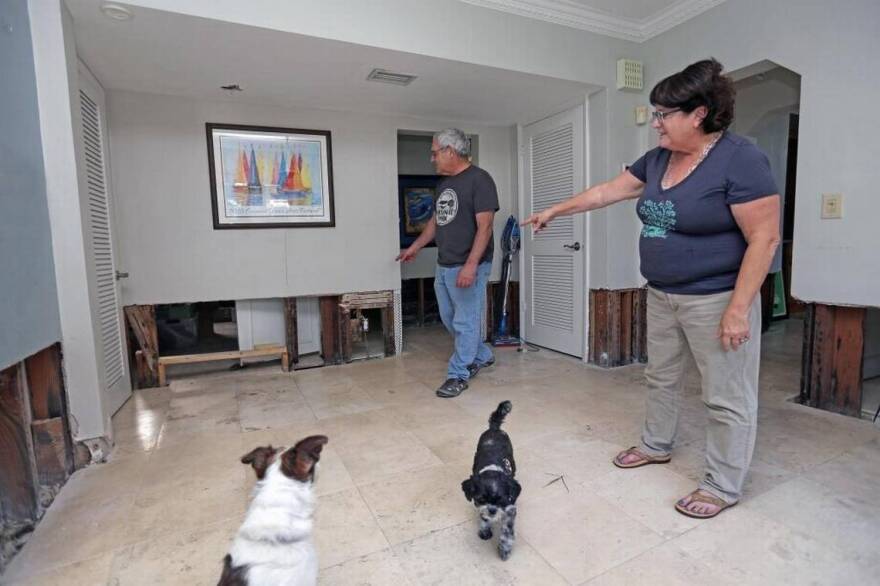
When Irma hit Coconut Grove’s shoreline, Penny Tannenbaum was relatively lucky: She evacuated, and her house on Fairhaven Place, a bayside street on a canal, got only a couple feet of flooding. But when she came back home, there was a foot of stagnant water pooled inside. Her floors, walls, furniture and cabinetry were ruined.
The stench — a mixture of mildew and low-tide muck — was unbearable; the contractors she hired for repairs walked into the house wearing gas masks. And all around, the streets were coated in a gooey layer of mud.
“It was kind of like you had to shovel snow, except it was this heavy, brown muck,” Tannenbaum recalled.
In all, the storm caused roughly $300,000 in damage to Tannenbaum’s home and possessions, and kept her out of the house for 11 months.

Both Irma and Ian were a closer call for Miami-Dade than many locals may realize.
The National Hurricane Center forecast for Ian called for significant surge along South Miami-Dade just before the storm track veered north and farther away from South Florida.
“The forecast had water all the way to U.S. 1 at Dadeland, and even over U.S. 1,” said Brian Haus, who chairs the department of ocean sciences at UM’s Rosenstiel School of Marine and Atmospheric Science and runs a lab that simulates storm surges. “That gives a good indication of how vulnerable we are.”
Had Irma also not changed its course, forecasts show, its impact on Miami-Dade would have been several times worse than it was.
On Sept. 7, 2017, three days before Irma reached Florida, the National Hurricane Center predicted the Category 4 hurricane would make landfall just south of Miami and then turn north to rip up the state’s east coast.

If Irma had stayed on that track, barrier Islands like Miami Beach and Key Biscayne would have been completely inundated at the height of the storm. In South Dade, floodwaters would have poured over every inch of Homestead, Cutler Bay, and Palmetto Bay east of U..S. 1, and eventually sloshed over the highway into low-lying land to the west that might have taken days or weeks to dry out. The Miami River and South Florida’s many canals would have acted like an aquatic highway system, giving water several paths to push deeper inland.
Despite storms, population soars
It’s happened before. Twice in the past century, Miami-Dade has seen storm surge as bad as Ian produced on the Gulf Coast.
Before Hurricane Andrew in 1992, the South Florida storm-surge record belonged to the unnamed 1926 Miami hurricane, which pushed 15 feet of sea water ashore in Coconut Grove. The storm also washed eight to nine feet of water across the width of Miami Beach. The official notes from the Miami Weather Bureau Office record the extent of the devastation.
“Miami Beach was entirely inundated, and at the height of the tide, the ocean extended to Miami,” bureau chief Richard Gray wrote in 1926. “All the streets near the ocean at Miami Beach were covered with sand to a depth of several feet, and in some places automobiles were entirely covered. One automobile dug from the sand several days after the storm contained the bodies of a man, his wife, and his two children.”
Hurricane Andrew, a Category 5 storm and one of the strongest ever to strike the continental United States, shattered the 1926 record. At the floodwaters’ highest point, as measured by the layers of grime deposited along the second-story walls of the old Burger King headquarters in what is now the town of Palmetto Bay, the water reached nearly 17 feet above normal sea level. The surge demolished a wood-frame mansion at the nearby Deering Estate and deposited a 105-foot research boat into the backyard of a neighboring mansion on Old Cutler Drive.
Yet Andrew was a compact storm. The scope of surge it produced, though intense, was tightly circumscribed.
Since then, the numbers of people and homes in some of the most susceptible areas have swelled. In the past 20 years, development has brought thousands of new condos, apartments and houses to Miami’s flood-prone Edgewater and Brickell neighborhoods, to surge-vulnerable suburban Coral Gables and Cutler Bay, and to the filled-in sandbars of Miami Beach and Sunny Isles Beach.

In Brickell alone, extensive new high-rise construction has driven total population from nearly 55,000 in 2010 to 68,716 in the 2020 Census. In the 33131 ZIP Code, one of three covering Brickell, the number of housing units quadrupled between 2000 and 2020, Census figures show.
In Key Biscayne, the tally of year-round residents has risen from 10,500 in 2000 to 14,800 in 2020, as the number of housing units went from 4,240 to 6,929. Coral Gables, much of which is vulnerable to flooding and surge because of a low-lying shoreline and a system of canals, saw its population rise by 7,000 people in the same period, to 49,250. Cutler Bay has added about 5,000 residents since 2010, with a population today exceeding 45,000.

In Miami Beach and the towns extending north to Sunny Isles Beach and Golden Beach, year-round population has remained steady as many part-timers have bought new high-rise homes, but the number of housing units shot up by 40,000 after 2000, to 105,000 in 2020, Census data shows.
Small storm track shifts, big storm-surge changes
All of those are at risk of significant surge and subject to evacuation in a major storm. But experts fear some people may not fully grasp the threat posed by surge or fail to understand the nuances in forecast data. Confusion or misunderstanding over Ian’s shifting forecast track may have delayed evacuation orders in Lee County and contributed to the high death toll when many residents stayed home as the hurricane rapidly gained strength and tilted south before striking.

Only a few miles’ shift in the path of a storm can make the difference between devastating storm surge like that seen in the Fort Myers area and minimal damage, UM’s Haus noted. Hurricane Andrew veered at the last moment and caught many people at home in its strike zone.
“Ian was a very good example of this,” Haus said. “Had it tracked anywhere close to the forecast two days out, even 10 miles to the north, Port Charlotte would have been hit with catastrophic surge even worse than Fort Myers Beach.”
The lesson, he said: “Heed evacuation orders. Don’t think the forecast is going to be perfect. Consider the worst-case scenario. Be happy if it doesn’t happen.”
Haus said a range of factors, including local topography and a storm’s direction, wind speeds and the size of its wind fields, affect how much water it pushes, and where.
On the eastern side of Florida, catastrophic storm surge is a little less likely than on the western side of the state.
The west coast of Florida is surrounded by a 150-mile-wide ridge of shallow water known as the west Florida continental shelf. Like Biscayne Bay, all that shallow water on the Gulf Coast helps storm surge pile up higher. On the east coast, by contrast, the continental shelf only extends about a mile from shore at its narrowest point near the border between Broward and Palm Beach counties.
That means deeper ocean waters off Key Biscayne and the Beaches can absorb more of the hurricane-driven water so it doesn’t mount as much.

'It's not theoretical'
Still, according to the National Hurricane Center’s storm surge risk map, the risk of surge higher than nine feet in a Category 4 storm extends along much of the mainland coast of South Miami-Dade along Biscayne Bay, certain points along the Miami River and various canals, and the back part of barrier islands like Key Biscayne and the Beach. The bayfront of Miami Beach, in fact, sits lower than the oceanfront, making it more vulnerable to surge as it’s driven across the bay.
The Hurricane Center surge maps show a Cat 4 storm would send crashing waters for miles inland in some areas. Surging saltwater could overwhelm the east side of Miami Shores and Miami’s Upper East Side, overflow the Miami River all the way to Hialeah, devastate Coral Gables neighborhoods east of Old Cutler Road with more than nine feet of water, flood Pinecrest and invade farmland east of Homestead.
Hurricane Ian actually drove home the potential perils to Key Biscayne residents, village planners said — but days after the storm exited Florida’s central coast east of Orlando. A week afterwards, the disturbed weather patterns it left in its wake sent “a freight train” of waves onto Key Biscayne’s beaches, which took a pummeling, said village planning director Jeremy Calleros-Gauger. The waves pushed masses of sand over dunes restored to blunt storm surge, and onto the edge of beachfront parks and properties.
“There were people surfing off the Key Biscayne beach, and that’s something you never see,” Calleros-Gauger said.
Added Samimy, the village resilience officer: “The beach took a beating. It makes the point very clearly to residents. People can see it. It’s not theoretical.”

However, the experts say, even the best rules, engineering and natural defenses won’t eliminate the risk to human life if people don’t take it seriously enough. They fear many locals have forgotten the long-ago lessons of Andrew even as thousands of newcomers have never experienced a tropical storm of any kind. They worry many would fail to heed evacuation orders that, in a major storm, would require tens of thousands of people to leave their homes.
Miami-Dade Mayor Daniella Levine Cava says she’s confident the county’s warning system won’t leave anyone in the lurch when a major storm threatens major surge. The system’s surge zones are clearly designated and the county offers assistance in the form of circulating shuttles to take residents to shelters, she noted.
“We have a very robust plan,” she said. “I feel confident that we do have what it takes to manage in a storm.”
But Hector, the UM architecture professor, said he fears Miamians have grown complacent. Public officials like Levine Cava publicly stress that every household should have a plan if they’re ordered to go, or to be prepared to wait out several days at home without aid if power and water are out.
Yet Hector found himself in line for basic supplies in a mobbed big-box store at the last minute when a storm last made a serious threat.
“We’re supposed to be prepared,” Hector said. “We’re not supposed to be standing in line buying plywood the day before a storm.”
McClatchy data reporters Shirsho Dasgupta and Court Cox contributed to this article.
This climate report is funded in part by a collaboration of private donors, Florida International University and the Knight Foundation. The Miami Herald retains editorial control of all content.
This story was produced in partnership with the Florida Climate Reporting Network, a multi-newsroom initiative formed to cover the impacts of climate change in the state.


