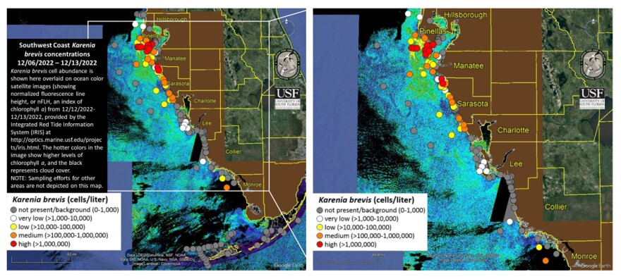
Red tide is continuing its march northward along the Pinellas beaches.
Thirteen sampling sites around the southern half of the county were found to have high concentrations of the organism that causes red tide. They range from Boca Ciega Bay to Fort De Soto.
Also, high concentrations were found this week in Sarasota Bay, with medium amounts at Longboat Pass. In Manatee County, medium concentrations were found at the southern fishing pier of the Sunshine Skyway, and off Little Redfish Creek in Tampa Bay.
Fish kills and respiratory illness though to be related to red tide were reported in Pinellas, Manatee and Sarasota counties.
Anyone who has respiratory issues is urged to stay away from the beaches and use air conditioning.


