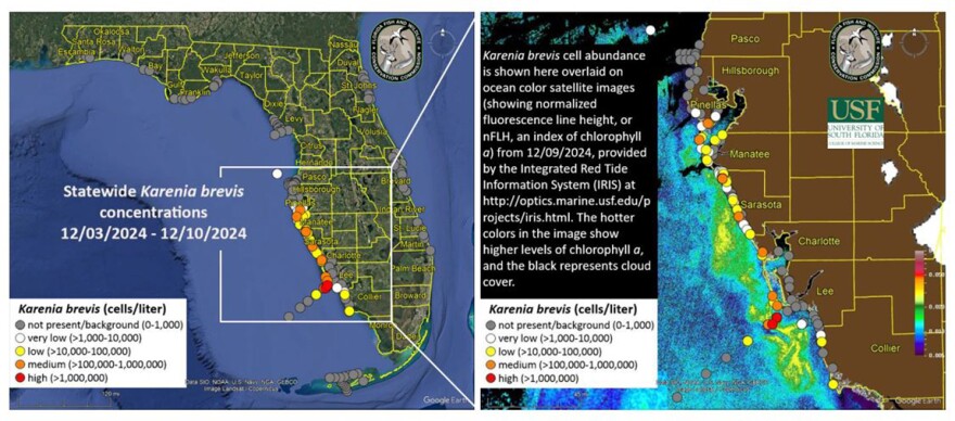
Red tide is continuing to foul beaches from southern Pinellas to Sarasota counties.
The latest report from state environmental officials has medium concentrations of the toxin in four areas. They are at Wallace Cove — just north of the Sunshine Skyway bridge, Egmont Key, New Pass Dock on Sarasota Bay and the Venice fishing pier.
Lighter concentrations are found in multiple locations from the mouth of Tampa Bay south to Sarasota Bay.
Fish kills that might have been caused by red tide were reported in Pinellas County. And respiratory irritation was reported in Sarasota and Pinellas counties.
Forecasts provided by the USF-FWC Collaboration for Prediction of Red Tides for Pinellas County to northern Monroe County predict northward transport of surface waters through Friday, followed by a reversal to southward transport through Saturday and southeastern transport of subsurface waters over the next 3½ days.


