Tropical Storm Colin has formed in the Gulf of Mexico and is expected to make landfall in Florida, according to the National Weather Service.
The storm, which has sustained winds of at least 39 mph, was upgraded from a tropical depression just before 6 p.m. Sunday.
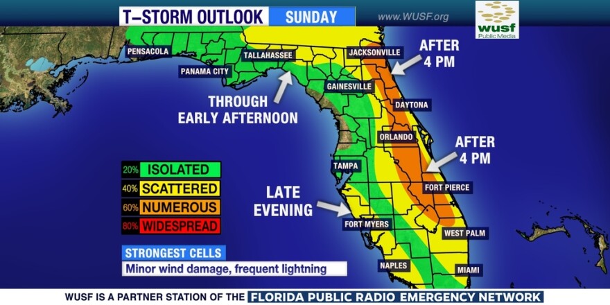
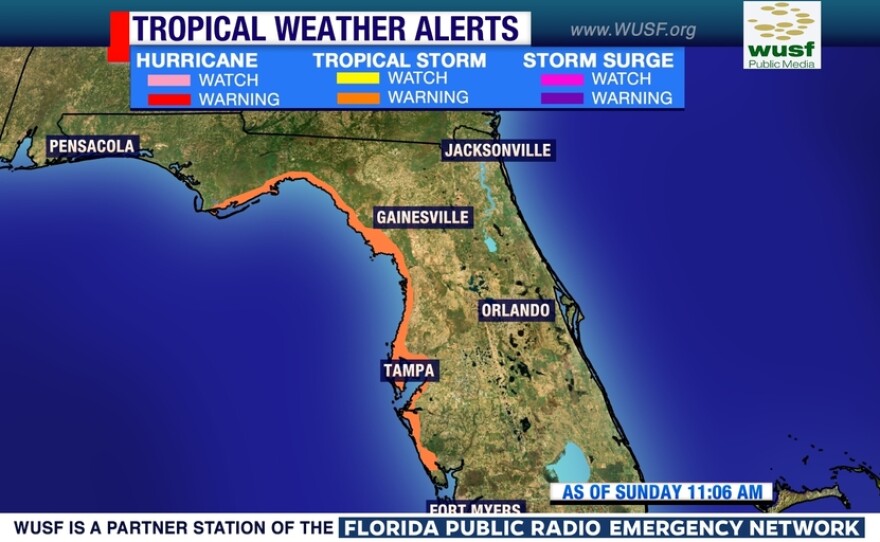
The National Hurricane Center issued tropical storm warnings Sunday, from Indian Pass in the Panhandle to Englewood, south of Sarasota. This also includes the Nature Coast and Tampa Bay metro areas. The primary hazards with this storm will be heavy rain and possible flooding, minor wind damage and isolated tornadoes.

The National Weather Service says a Tropical Storm warning means that tropical storm conditions are expected somewhere within the warning area within 36 hours.
Residents along the coast of northeastern Florida through southern South Carolina also should monitor the progress of this system.

Colin is expected to produce rainfall amounts of 3- to 5- inches with isolated maximum totals of 8 inches possible across Florida.
The combination of the storm surge and the tide will cause normally dry areas near the coast to be flooded by rising waters. From Indian Pass to Tampa Bay, the water could reach 1 to 3 feet above ground if the peak surge occurs at the time of high tide. South of Tampa Bay, the water could reach 1 to 2 feet.
The deepest water will occur along the immediate coast.
Surge-related flooding depends on the relative timing of the surge and the tidal cycle, and can vary greatly over short distances.
Tropical storm wind conditions are expected to first reach the coast within the warning area by Monday afternoon.
Isolated tornadoes are possible Monday afternoon across portions of Florida and far southern Georgia.


