Concerns of coastal flooding along Florida’s Nature Coast, and strong rip currents, remain the evidence of now-Tropical Depression Fred’s presence in the greater Tampa Bay region.
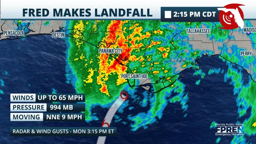
Fred made landfall Monday around 3:15 p.m. near Cape San Blas, south of Port St. Joe and Mexico Beach — which was decimated by Hurricane Michael nearly three years ago — with maximum sustained winds of 65 mph with higher gusts. It dumped 10 inches of rain in the Panama City area on Monday.
By early Tuesday morning, Fred had weakened into a depression in Georgia with maximum sustained winds of 35 mph with higher gusts, according to the National Hurricane Center. Forecasters say it will degenerate into a remnant low by Tuesday night as moves across western and northern Georgia, then across the Appalachian Mountains.

According to the National Weather Center, a coastal flood advisory for Hernando, Citrus and Levy counties expired Tuesday morning. Some rivers are also at elevated water levels.
"Trailing rain bands from Fred may cause flash flooding from the Nature Coast into north-central and northeast Florida,” said Ray Hawthorne, meteorologist with the Florida Public Radio Emergency Network.
To the south, beaches across Tampa Bay will be at the risk of dangerous rip currents, forecasters say.
Deep tropical moisture associated with Fred will produce scattered to numerous showers and thunderstorms on Tuesday, with the best chance of storms inland later Tuesday afternoon.
Clearing skies, coupled with the humid air, could result in hotter feels-like temperatures and possible heat advisories in some areas, forecasters say.
Meanwhile, Tropical Storm Grace continues to move west between Cuba and Jamaica but is expected to miss Florida, and Tropical Storm Henri is on track to stay over the open waters of the Atlantic near Bermuda.
Information from the Florida Public Radio Emergency Network was used in this report.


