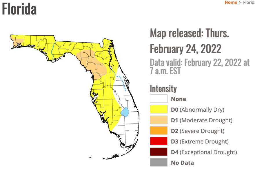
According to the U.S. Department of Agriculture’s weekly drought monitor, less-than-normal rainfall in Northwest Florida has led to drought-like conditions in parts of the Big Bend and Panhandle.
At the same time, the entire greater Tampa Bay region and surrounding counties are categorized as “abnormally dry.”
“We're running about three to four inches below average, conservatively, so far this year,” said Florida Public Radio Emergency Network meteorologist Megan Borowski
She said we should have received about six inches of rain by this time of the year, but so far, we’ve only see about two inches.
Other counties in Northwest Florida, including Levy and Marion, are under “moderate drought” conditions.
Borowski adds that most Florida residents need to be careful with outdoor fires burning during this time. Wildfire season typically peaks in Florida this month and next.
“So with those warm temperatures, dry conditions, it's going to dry out vegetation, and it will make for the quick spread of fires,” she said.
Borowski attributes these drier conditions and lack of rainfall to La Niña.
“Generally, that means drier winters and warmer winters,” she said.
In Florida, this pattern typically signifies warmer temperatures in the spring and an increased chance of hurricane activity out of the Atlantic.
“The thing that I drive home every year is that it just takes one storm and if it aims in your area, that can have a huge impact on your life and your family's lives and your property,” Borowski said.


