Florida saw close to average temperatures in the last month, but below-average precipitation in much of the state according to the Southeast Climate Monthly webinar. The meeting, co-hosted by NOAA and NIDIS, includes speakers from the Southeast Regional Climate Center, NWS Southeast River Forecast Center and the University of Georgia, who summarize the most important climate data of the last month.
Chip Konrad of the Southeast Regional Climate Center at the University of North Carolina at Chapel Hill presented the climate overview. The Panhandle saw generally normal or below-normal temperatures, while the rest of Florida experienced near normal or slightly above-normal temperatures. Similarly, most of Florida saw below-average precipitation over the past month, with the exception of the Panhandle which experienced average or slightly above-average rainfall.
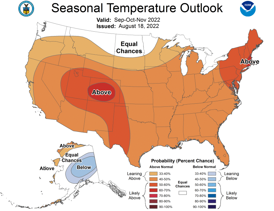
Conditions remain abnormally dry stretching from Miami-Dade County to Osceola County, with a pocket of moderate drought in Brevard County. Nearly the entire country is forecasted to experience above-normal temperatures though November. Florida has a 40-50% chance of above-normal temperatures. Meanwhile, the state has a 30-40% chance of above-normal precipitation through November.
Tropical activity in the Atlantic remains unusually low this season. Currently this period ranks second in the longest streak between named tropical cyclones during an Atlantic hurricane season. As of publishing, there has not been a named cyclone in 51 days, since Tropical Storm Colin in early July. There has not been a streak of inactivity this long since 1999, which reached a record 61 days without a named storm. There is a 20% chance of tropical cyclone development over the next five days. It is expected that activity will pick up over the next few weeks.


