As Hurricane Ian churns toward the Florida Gulf Coast, the state is bracing for a major evacuation with about 2.5 million ordered to leave.
At a morning press briefing, Gov. Ron DeSantis said road shoulders will be opened if sustained highway speeds drop below 40 mph, an attempt to head off the hours-long congestion that impeded evacuations during Hurricane Irma in 2017.
The state is also mobilizing rescue teams, shelters and other resources as it readies for what’s expected to be a major hurricane when it makes landfall, pushing a significant storm surge. Wind speeds are now expected to be between 125 and 130 mph when it makes landfall.
“Safety is paramount when you're talking about storm surge like this,” DeSantis said. “That water is a very, very difficult adversary. You do not want to put yourself in harm's way.”
Evacuation orders are now in place from Pasco County south to Fort Myers.
In their 11 a.m. advisory, National Hurricane Center forecasters said the storm has sped up, with landfall now expected six to 12 hours earlier. The eye of the storm emerged well-defined from the coast of Cuba. The storm size also grew, they said. The track has also continued shifting slightly to the south.
However, wind shear is forecasted to increase and slow hurricane winds now won’t be enough to weaken the storm before landfall, they said.
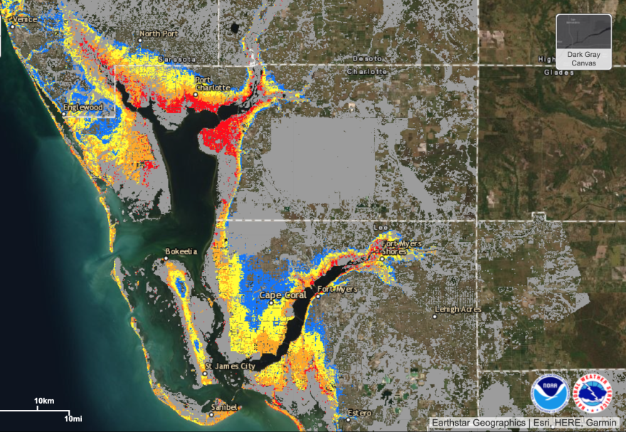
As the storm grows in size, heavy flooding from storm surge could hit Fort Myers, north to Tampa Bay. Heavy rain, not factored into the surge forecast, is likely to worsen that flooding.
To prepare, Florida has mobilized 5,000 National Guard troops. Search and rescue teams have been activated along with high water vehicles and shallow boats in areas likely to see heavy flooding.
About 90 hospitals and nursing homes in evacuation zones have begun to shut down, Florida’s emergency operations chief Kevin Guthrie said. Airports expected to see heavy winds have also begun closing, he said.
To help with evacuations, DeSantis said the state’s tourism bureau has teamed up with the travel website Expedia.com to help people find lodging. The state has also lifted highway truck weight limits to speed up the delivery of fuel. Highway tolls have also been suspended.
The state is also urging Gulf Coast residents to avoid evacuating north, a scenario that clogged highways during Irma. Instead, they should head east out of flood zones.
“You may only need to evacuate tens of miles…instead of hundreds of miles,” Guthrie said. “Many people in the southwest Florida area, your best bet is going to be to evacuate across the state. Just go straight across the state to Broward, Miami-Dade or Palm Beach. Do not try to go north.”
With the storm now forecast to cut across central Florida and emerge on the Atlantic coast, heading north could also put evacuees in more danger, DeSantis said.
“We were here 48 hours ago and most of the [forecast models] had it going up the coast, the west coast of Florida,” DeSantis said. “Now most of them have it ramming into the state of Florida and cutting across. So just be prepared for that and understand that that's something that could be happening.”
Copyright 2022 WLRN 91.3 FM. To see more, visit WLRN 91.3 FM. 9(MDAyNDY5ODMwMDEyMjg3NjMzMTE1ZjE2MA001))


