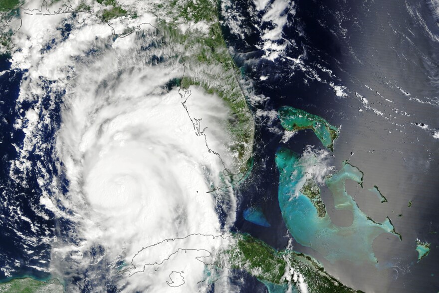
In the aftermath of Hurricane Idalia, one meteorologist says the storm could have hit Florida even harder had it slowed down.
Powered by warm waters in the Gulf of Mexico, Idalia grew from a tropical storm to a Category 4 hurricane in less than three days. It rocketed north at about 18 miles per hour on Tuesday evening and Wednesday morning.
Megan Borowski, a meteorologist for the Florida Public Radio Emergency Network, spoke on the Florida Roundup about Idalia’s rapid intensification. She said the storm's speed lessened its blow on the state.
“If it had more time to sit over the waters of the Gulf of Mexico, I do believe it would have gotten even stronger,” Borowski said. “And then also, the slower-moving storms, you have one area within the eyewall for a longer amount of time, and that can really just decimate whatever location is in its path.”
Idalia also turned to the east, sparing areas like Tallahassee from the worst effects.
“I will say Tallahassee is quite lucky that they were on the west side of the storm. I mean, we did have some damage, some wind damage, downed trees, but as we know, the west side of the forward motion, you have weaker winds. On the right side of the forward motion is where we have the worst winds,” Borowski said.
With the peak of hurricane season two weeks away, Borowski said more people should focus on flooding when it comes to storm forecasts.
“The biggest killer with a tropical cyclone is going to be flooding, either from storm surge or from freshwater and rainwater flooding,” she said.
Development along the Florida coastline is also affecting forecasting. Borowski said taking away natural barriers like mangroves will make the impacts of storm surge much worse.
“The more development that we do have directly along the beach is going to mean there’s more human impacts,” she said. “You have those structures right there. Well, there’s a good chance that … you’re going to be impacted by a tropical cyclone, or even abnormally high tides, or even if we have just a strong cold front come through, and we have those downshore winds. That’s all going to increase our chances of dealing with flooding.”
In the short term, Borowski said meteorologists are watching five areas in the Atlantic Ocean, including four named systems and a tropical depression.


