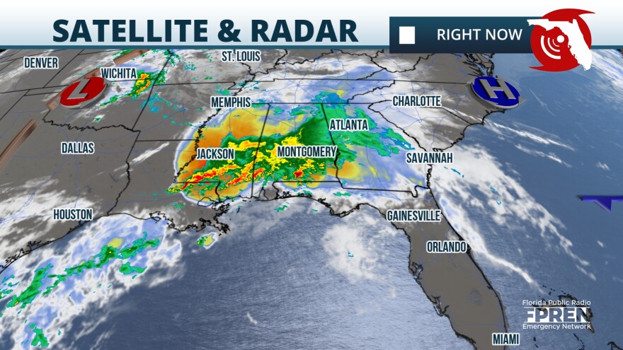
Severe storms are moving from the west and along a warm front that is approaching the Gulf Coast. There is a tornado watch in effect for Northwest Florida and the Panhandle at least through 7 p.m. Monday. This means that storms could produce tornadoes this afternoon.

For Monday, the main threat with the storms will be tornadoes and damaging winds. Some storms this morning have produced winds of at least 75 mph and there is a good chance that some of the storms could continue producing damaging winds through the early evening. There could be a break in the early evening hours from the storms, but don't let your guard down as there will be another round of strong to severe storms overnight into Tuesday morning. These storms could also produce damaging winds, hail, and tornadoes.

Make sure to have at least three ways of receiving weather alerts today and seek shelter as soon as a severe storm warning is issued for your location. Stay away from doors and windows and up to the latest with the weather information.

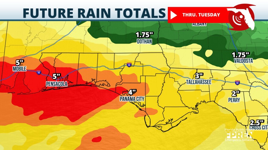
Flood risk increases along the I-10 corridor
The ground is still well saturated from recent rains, and the torrential rains will continue through Tuesday evening which will elevate the risk for flooding along the Panhandle. Rain totals will range from 2 to 5 inches, but there could be some isolated areas with up to 8 inches of rain.

By Wednesday morning, some storms could be possible over North Florida, affecting Gainesville and Jacksonville, through the morning commute. Some storms will be producing frequent lightning and torrential rains. By the late morning the front will lose its punch and the chance for storms will likely diminish for the afternoon as the front tries to move south over the rest of the Peninsula.
There will be a drastic difference in temperatures between the northern half and southern half of the state on Thursday. Highs in the mid to high 80s for the northern half with not-so-humid air, while the southern half will continue with highs in the mid-90s and plenty is humidity making it feel much hotter.


