-
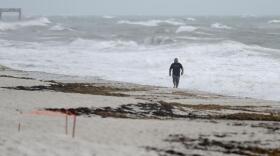
 This upcoming season is shaping up to be an above-average one — but not as busy as last year. Forecasters still warn that it only takes one destructive storm to make it a bad hurricane season.
 -
 Not sure if you're in an evacuation zone? Here's how to find out.
 -
 What you need to know about the different weather factors that could make for a dangerous hurricane season.
 -
 The cold front could produce scattered afternoon showers and thunderstorms later this week as it sinks to the south.
 -
 Researchers say the anticipated absence of the El Niño weather pattern might make for yet another "above average" Atlantic hurricane season.
 -
 Friday PM Update: The Storm Prediction Center has increased the threat levels for severe thunderstorms on Saturday. Areas along and north of I-10 are...
 -
 An additional 1 to 3 inches of rain is expected Tuesday.
 -
 A few showers could make it as far south as the I-4 corridor and as far east as the First Coast around rush hour, and a few showers and storms are possible Friday along the I-4 corridor near a stalled out front.
 -
 A powerful line of storms continue to move through the greater Tampa Bay region. A severe thunderstorm watch is in effect until Sunday at 4 p.m., and a 17-year-old girl was killed Sunday when she exited her car and stepped on a downed power line.
 -
 The predictions call for 17 named storms for the North Atlantic, with eight becoming hurricanes and four reaching major hurricane strength.
 -
 The best chance of storms from the greater Tampa Bay region to the Orlando metro areas and southward is late Saturday night into Sunday.
 -
 Some areas could see gusty winds and hail.

© 2025 All Rights reserved WUSF
Play Live Radio
Next Up:
0:00
0:00
Available On Air Stations


